
By MICHAEL SCHREIBER
The proposal to restore a portion of the land at Gloria Dei (Old Swedes’ Church) in Philadelphia to attract wildlife is very timely. Its status as a National Historical Park and its location within a big city can help to make Gloria Dei a prominent example of ecological land management that others can copy.
The new project has been dubbed “Sven’s Woods,” after Swedish settlers Sven Gunnarsson and his son Sven Swanson, who both lived there in the 17th century. The new wooded area would extend the efforts at nearby Washington Avenue Green to transform former industrial properties along the Delaware River into parkland, restoring them with native plants and trees.
But proposals to reclaim the district for nature and recreation are under continual threat by building schemes.

One developer, for instance, has released plans to construct ten high-rise apartment blocks, some over 30 stories tall, on the riverbank merely one block from Gloria Dei. And a proposal next to it (the former projected site of the Foxwood casino) would construct an automobile-oriented shopping center, big parking lots, and housing. Together, the schemes would destroy a large swath of land that now is prime habitat for birds and a pleasant retreat for hikers and bicyclists along the Delaware River.
On the whole, habitat for wildlife is continuing to erode in the Philadelphia area as woods and farmland are bulldozed for housing, highways, and shopping centers. Moreover, contemporary architectural practices—taller buildings, increased lighting of buildings, and the current style of using large areas of plate glass—are responsible for the deaths of a great number of birds. It is estimated that there could be as many as 40,000 collisions of birds per year as they migrate in the skies over Philadelphia.

Increased flooding is another consequence of the steady process of covering the landscape in concrete. This coincides with changes in the climate during the last half-century that have made average annual precipitation from heavy storms increase 70 percent in the Northeast United States. Rising temperatures in the future will melt snow earlier in spring and dry the soil during the summer—intensifying flooding during the cold season while bringing drought in the hotter months of the year.
It is estimated by some agencies that because of climate change, and the fact that the Delaware Valley is sinking, the river could overflow large areas of Philadelphia, rising as much as four feet by 2040. (The EPA says, more conservatively, “by the end of the century,” but of course, the amount and rapidity of sea level rise will depend on the degree to which people are able to mitigate the build-up of greenhouse gases in the atmosphere.) Large areas of Philadelphia close to the waterfront—such as the Navy Yard and the airport—could be submerged, and even the area adjacent to Gloria Dei could be subject to flooding.
There is a corresponding threat that the rise in salinity of Delaware River water will endanger our drinking supply and destroy much of the tree life along the riverbanks—i.e., the seawater rise caused by Hurricane Sandy wiped out large stands of Atlantic white cedar in South Jersey. This underlines the importance of conserving green areas along the riverbanks, and of protecting the habitat of wildlife that will be under increasing stress.
On the Atlantic flyway
Although the proposed woodland at Gloria Dei property would be fairly small in area, it lies strategically along the Atlantic flyway and at the juncture with a branch flyway from the upper Midwest. Nearby areas like the Heinz National Wildlife Refuge are a magnet for migrating waterfowl and songbirds.
Nevertheless, the numbers of birds have declined markedly from when the region was still mainly rural. Two centuries ago, for example, the passenger pigeon was the dominant bird species in the area; flocks sometimes contained over a million birds. Now the species is extinct.
Bobolinks (known as “reed birds”) regularly stopped to feed in the marshes and meadows just south of Gloria Dei during their semi-annual migration to and from South America. In fact, their numbers probably multiplied in the 18th century as the forests were cut down for farm fields—but now they are much rarer. Mechanical threshers kill legions of young bobolinks each year in the Pennsylvania hayfields.

Yet all is not bleak. The Audubon Society’s 2016 Mid-Winter Bird Census points out that Philadelphia, despite the fact that it is heavily developed, has one of the most diverse bird populations of any county in Pennsylvania. Although a few species are declining in numbers in the city, mainly due to habitat loss, the census still recorded 107 species of birds last year, including a few rare ones. Enhancing the habitat at Gloria Dei can help feed and protect the birds and keep their numbers up.
Looking backward through the centuries
In order to begin to restore the land, it would be useful to understand, as a reference point, what it looked like before it was built upon. To do that, we must look far back—over 350 years ago, when Swedish and Finnish farmers began to settle the area. And even before that, of course, the Lenni Lenape people lived in the area and named it, according to different transliterations by the Swedes, Wickanocoing, Wiquakonich, or Wichqua Coing (shortened to Wicaco). It is thought that the Lenape maintained a settlement, which they used at least seasonably, at the current site of Gloria Dei.

Since that era, at least two generations of buildings were constructed in the area of the Gloria Dei property that is to be ecologically restored. In the 18th century, a number of houses were built there. Later, most of the houses were replaced by industrial buildings. A lye works and a soap manufacturer operated there in the late 19th and early 20th centuries. About 40 years ago, the remaining buildings were cleared by the National Park Service, and trees and grass were planted.
Of course, it is not possible to restore the area to its appearance in the 17th century. Too many radical changes have taken place in the interim—the creeks covered over, wetlands drained, and forests cut down. The shores of the river have been moved much further east, and the land covered with buildings and parking lots. Gloria Dei is now surrounded on three sides by heavily trafficked streets and highways—including the elevated I-95 expressway. Noise from trucks is a constant factor, and we might expect to find a significant amount of pollution in the soil and air.
Another example of modern landscape adaptations is the presence of a large ginkgo tree on the Gloria Dei grounds. The tree was probably planted with good intentions by the National Park Service, but ginkgos are native to China, not Pennsylvania.
Nevertheless, it would be useful to try to recreate in the selection of plants a representation, a small glimpse, of what used to be. For a National Historical Park, education in history is obviously a key part of the mission. Identifying labels might indicate, for example, which plants were used by the Lenape people or early European colonists for food, medicines, basket weaving, etc.
A narrow ridge along the river
Gloria Dei Church was built towards the northern end of a low ridge paralleling the Delaware River, just south of the outlet of Wicaco Creek (the creek ran close to what is now Christian Street).

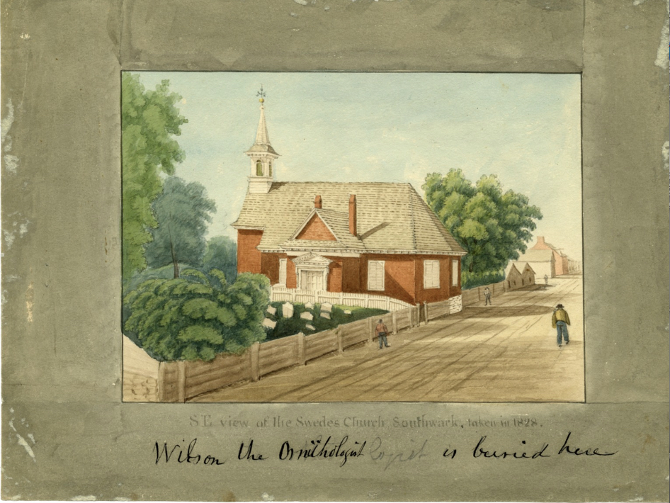
The current church building, begun in 1698 and consecrated in 1700, is at the highest point of the ridge, sitting perhaps 15 feet above the high tide of the river. The ridge once seemed higher than it does now, since the ground surrounding it has been raised in height—including Swanson Street in the east (which used to run as a causeway directly along the banks of the river), Water Street in the west, and Christian Street in the north.

In his “Annals of Philadelphia in the Olden Times” (first published in 1830), John Fanning Watson said that the hill where the present church sits was lowered about eight feet from its original height. He points out that the stone foundations of the church, which are now exposed on the Swanson Street side, used to be completely underground.
Nevertheless, most of the ridge probably remains fairly close to its original height, since graves in the churchyard that predate the church building remain buried. The oldest date that is still readily visible on a tombstone close to the church is 1708, but the first burials probably took place on the property some four decades earlier. (A fortified wooden church was established there in 1677, and it is thought that landowner Sven Gunnarsson, who died soon after 1680, was one of the first to be buried in the churchyard.)

The Wicaco ridge extended south almost half a mile to about where Wharton Street is today. At that point, the land dropped into a valley, through which a small creek ran into the Delaware (just south of what became Reed Street in 1829). Continuing along the river to the south, the land was relatively flat and open (this was called Wicacoa Meadows in the second half of the 18th century), and it became marshy further south in the vicinity of Hay Creek (also called Moyamensing Creek, around present-day Oregon Avenue).
in 1655, the Dutch defeated the Swedish garrisons in the Delaware Valley and the area was put under Dutch rule. In May 1664, the Dutch governor confirmed a patent granting the 1125-acre tract of Wicaco—all the land above Hay Creek, extending two and a half miles to the north—to Sven Gunnarsson and his sons, the “Swanson” family. That was one of the governor’s last acts since the English conquered New Amsterdam that year, and the territory along the Delaware came under English administration.
The valley of Wicaco Creek was connected to the small stream valley in the south (near Reed Street) by a gully or ravine, just to the west of Gloria Dei, where Water Street is now located. This ravine appears on maps even at the end of the 18th century (see John Hill’s 1796 map, for example). Watson, writing in the 1840s, points out that the “remarkably low ground” to the west of Gloria Dei still existed and that it had a pebbly surface, suggesting that it once communicated with the Delaware River.

Thus, it appears that the land on which Gloria Dei sits might once have been a small island, surrounded by water. It is doubtful, however, that this condition still existed by 1669, the year that the Swedish settlers, now under English governance, built their blockhouse there. Yet the fact that the high ground at Wicaco not only commanded the river but was surrounded on three sides by a gully must have had distinct advantages for defense against invaders. In the next century, Benjamin Franklin and others built a battery on the ridge to protect the city of Philadelphia.
On the western side of the Water Street depression, the land rose again, with a hilltop around present-day Fifth and Federal Streets, where the mansion of the Wharton family, Walnut Grove, was built in the early 18th century. That hill was a continuation of a ridge that extended northeast, with its highest point at Society Hill (now Front and Lombard Streets). The ridge then paralleled the Delaware River as it ran northward, descending to the mouth of Dock Creek, rising again to around Market or Arch Streets, descending to Race Street, rising again, and descending to Willow Street (the marshes around Pegg’s Run) in the Northern Liberties.
According to J. Thomas Scharf’s and Thompson Wescott’s “History of Philadelphia, 1609-1884,” the city’s bluffs and ridges along the Delaware were formed partly by movement of glaciers. That does not seem correct to me, since the glaciers did not penetrate this far south in the Delaware Valley (stopping on a line more or less directly west of New York City). It was likely the action of the river itself, as it cut its way along the western edge of the sandy and gravelly soil of the Atlantic coastal plain, that was largely responsible for the series of parallel ridges that are characteristic of southeastern Philadelphia.
Wicaco Creek
What remains of Wicaco Creek now runs in a large sewer under Christian Street, which often overflows during heavy rains. In earlier times, the little creek and its valley afforded a relatively clear route through the forests for the Lenape people to travel from the west. And the Swedish settlers followed the same route to attend their church at Wicaco. Families living near the small village and trading post at Kingsessing, on the west bank of the Schuylkill, or in the vicinity of the Lutheran parsonage (glebe house) on the east bank, took the paths that later became the Passyunk Road and the Moyamensing Road to where they met another path following Wicaco Creek, which they followed to the banks of the Delaware.

As mentioned, the historic creek valley was lower and steeper than it is today as it descended to the river. John Fanning Watson points out in his mid-19th-century “Annals of Philadelphia in the Olden Time” that some older houses along Christian Street, just north of Gloria Dei, showed definite signs that the land around them had been raised. It could be seen, said Watson, that their current underground cellars were once used as ground floor parlors, and people were now obliged to enter the houses through what used to be their second floors.
Watson indicates, from conversations with elderly residents of the district, that there once was a wide inlet where Wicaco Creek flowed into the Delaware—deep enough so boats could float in it. But that “fact,” based on people’s childhood memories, is difficult to verify. Maps of the 18th century show neither an inlet nor the creek itself—suggesting that the creek had been both shallow and narrow, and that whatever inlet might have existed was soon covered over by the Swanson Street causeway and wharves into the Delaware. However, a pond near Third and Queen Streets, which probably was linked to the creek, does appear on maps even at the end of the 18th century.
Which trees were at Wicaco?
It is not unlikely that the Wicaco ridge was forested, since we know that deep forest covered the high ground just to the north, where William Penn purchased land from Sven Gunnarsson’s sons to build his city of Philadelphia. Early settlers reported that the land was covered by vast stands of tall and ancient trees—perhaps over a million trees just in the area within the boundaries of Penn’s city. There was a relatively small amount of younger undergrowth, permitting people to often walk unobstructed through the forest. Although diverse species of hardwood (deciduous) trees predominated, coniferous trees were also there in abundance. The Lenape name for the area was “Coaquannock,” the “place of pines” or “grove of tall pines,” which we might assume was a notable feature of at least one portion of what became Penn’s land.

Penn wrote: “The soil is good—air serene and sweet from the cedar, pine, and sassafras.” And Penn referred to other trees on the land: Black walnut, chestnut, poplar, gumwood, hickory, ash, beech, oak (white, black, and red), white and red mulberry, etc. Some of these trees gave their names to east-west streets in the new city.
Deeds for land to the south of the city, where meadow predominated, mentioned some of the same trees as landmarks. Thus, a 1684 patent that Penn gave to Lasse Andrews and other farmers maps out the boundaries by stating: “Begin at an oak by the side of Hollander’s Creek … SW to an oak by Hay Creek, NW to an ash by swampside parcel of meadow … poplar by Hay Creek … to oak by Rosemond Creek.”
The same species of large trees probably appeared on Wicaco ridge. Perhaps trees that thrived next to bodies of water, like willows, could also be found along the banks of Wicaco Creek.
The map of the Delaware River Valley produced by Swedish engineer Peter Lindstrom in 1654-1655 notes a place called “Wichqua Coing” in the Lenni Lenape language. Thomas Campanius Holm, in his “Description of the Province of New Sweden” (1642, translated 1834), uses a similar name, “Wiquakonich.” That is sometimes translated as being derived from “wikquek” (“head of creek”) and “kuwe” (“pine tree”), or “the grove of pine trees next to the head of a creek.” And many believe that Europeans shortened “Wiquakonich” into “Wicaco,” in a reference to the land around what is now Gloria Dei.
But this is merely speculation. For our purposes, it is not possible to definitely conclude from Lindstrom’s map or Campanius’ manuscript that a specific grove of pines stood next to Wicaco Creek, although pines and other conifers, such as Atlantic white cedars, were numerous in the area.

The only definite reference I could find concerning the trees at Gloria Dei appeared in Watson’s “Annals.” Watson states from his conversations with people who could remember how the area appeared in the mid-18th century that “an old stand of large water-beech or buttonwood trees” stood near Sven Gunnarsson’s house and also by “the Swedes Church.” He said that one was still standing in his own time (the 1840s).
Watson’s tree identification is confusing, however. Buttonwood trees are a popular name for sycamores, not water beeches. And water beeches are a species common in the American South, not in Pennsylvania. So were these ancient trees sycamores, water beeches, or perhaps a native species of beech tree? Mis-identification is a general problem that I found in my research. In another example, Penn refers to “a wild myrtle of great fragrance” that he found in Philadelphia. However, no true myrtles are native to the Americas.
It will take quite a few more years until the new Sven’s Woods is planted, and many years after that until the trees are mature. Before any planting takes place, we can expect that arborists will carefully review what species of trees might be best for the area. They will naturally take into account the fact that this is no longer a pristine portion of “Penn’s Woods” but a neighborhood within a large, noisy, and polluted city. Also, trees will have to be chosen to withstand the effects of climate change. And finally, the new woodland will have to be designed to encourage the visits of people—and their four-footed companions (on a leash, of course)—along with wild creatures such as birds, butterflies, chipmunks, salamanders, and bats.
New plantings at Gloria Dei
In conclusion, I would like to offer some suggestions for new plantings in the restored lands at Gloria Dei. I think that historical research on the area offers a few examples of trees that might be chosen. But the following criteria should be taken into consideration:
The primary stated objective of the nature preserve at Gloria Dei would be to attract and shelter wildlife. Since the property is isolated and fairly small, we can expect that the mammals that visit would be those that are already seen in the neighborhood—such as rabbits, squirrels, mice, and occasional raccoons and opossums. The main visitors would probably be creatures that can fly in and out—including birds, bees, moths and butterflies (and perhaps bats?).
For this purpose, we should give prominence to flowering plants, and those that yield berries, seeds, nuts, and acorns (squirrels, jays, crows, rabbits, raccoons, opossums, and other animals eat acorns). An open meadow—perhaps containing some wild grasses along with milkweed, black-eyed susans, goldenrod, sunflowers, or other seed-bearing plants—can bring in many birds, butterflies, and bees. Clippings and decay from several generations of these plants (i.e., mowing at the end of the season) will help to maintain the soil. This will help worms, grasshoppers, and small insects to multiply, which catbirds, robins, cardinals, orioles, and other songbirds eat.

Creating a meadow, at least as an interim use of the land, is relatively easy. It is easier to maintain than a grass lawn. It requires very little tilling of the soil, or soil remediation or fertilizing, as long as there is good sun and reasonable drainage. As a sample experiment, we could begin creating a small fenced-off field for annual and biennial flowering plants beginning this autumn, which would bloom in the spring. (We could even plant a few perennial flowers or small shrubs if we are ambitious.) There are a number of on-line resources that explain how to plant a meadow. It can be done fully by a few volunteers (perhaps by enlisting the community and congregation to help), and requires minimal expense for seeds. A low fence to keep dogs and people from trampling the tender shoots would be an additional expense.
Thickets of small trees and bushes on the edge of the meadow would provide shelter for many songbirds. What about taller trees? The property already has a number of large spreading shade trees, and there is not enough space to add many more tall trees without blocking sunlight to the meadow. But I think a handful of potentially tall trees (maybe one or two) might be planted in the far southwest corner of the property, where they would serve to help block the noise from I-95, and perhaps one or two others in the northeast corner, where other trees already stand and a small “woodland” could be created. Even in those locations, however, in order to maximize the areas that receive sun or only partial shade, it would be best to choose trees that have a narrow crown rather than ones that tend to spread, and to give priority to smaller trees rather than tall dominant ones.
A good tree to choose, of medium height (30 to 50 feet), might be the post oak, Quercus stellata, which was one of the native trees called “white oak” by early colonists in the area. It lives under a variety of conditions, from dry rocky ridges to moist loamy soils in flood plains. Acorns from white oaks are generally more palatable to wildlife than those from red oaks, but those from red oaks last longer, providing food into the winter and spring.

The northern red oak, Quercus rubra, is generally taller than the post oak (60 to 90 feet); it also thrives under a variety of soil conditions. This tree is relatively fast growing, and offers dense foliage—which might prove useful if one or two were planted in the southwest corner of the Gloria Dei land to help block out noise and pollution from I-95. Orioles like to nest in oaks, and they attract woodpeckers.
The red maple, Acer rubrum (60 to 90 feet) is also very adaptable, has varieties with a relatively narrow and pyramidal shape, and has striking red autumn foliage. I planted a variety of red maple with a narrow shape in our garden around four years ago. It has grown fairly quickly—now about 25 feet high—and a gray catbird can often be found perching in its branches in recent months.
The red mulberry, Morus rubra, (short trunk, to 60 feet) might be a good choice. Songbirds eat the berries.
I think that the sassafras, Sassafras albidum, would be an excellent choice. It grows to a medium height (30 to 60 feet), flowers in the spring, and gives berries in autumn. This, of course, is one of William Penn’s trees that “sweetened the air.” It prefers moist soils, but is often found on the edge of old fields.

However, as mentioned above, smaller trees should be chosen for the most part. One selection might be the downy serviceberry, Amelanchier aborea, which grows as a shrub or as a tree to about 40 feet in height. The tree has showy white flowers in spring. Serviceberries are small apple-like fruits that are edible by people as well as animals.
The Eastern flowering dogwood, Cornus florida, is a native small flowering tree (to 30 feet). In the autumn, it yields red berries, which a number of birds and small mammals like to eat (although they are poisonous to humans). The Native People made a red dye from the roots. Also, Alternate-leaf dogwood, cornus alternifolia; blue-black berries in late summer are consumed by wildlife.
Finally, I have always loved the elderberry (American elder), sambucus canandensis, which grows as a bush or small tree to about 16 feet. I have enjoyed the wine that my friends in England make from its flowers and berries, and many songbirds and mammals eat the berries.

It is my understanding that the English conquered the Dutch settlement of New Amsterdam in 1664 and not in 1654 as was reported in the text above.
LikeLike
Thank you for your comment. The text has now been corrected, although belatedly.
LikeLike